The History of Civil Lines: Colonial Town Planning in British India
Bottom Line
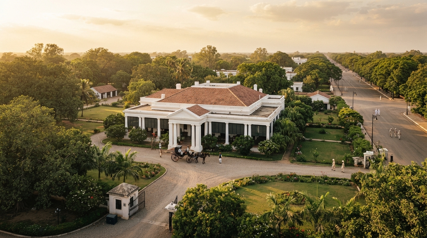
Civil Lines are segregated residential and administrative districts established across British India to house civilian colonial officers. Developed primarily after the 1857 rebellion, these low-density enclaves utilized geometric grid layouts, expansive avenues, and sanitizing buffer zones to isolate British administrators from dense indigenous quarters, fundamentally restructuring colonial Indian urban geography.
Key Takeaways
- Over 60 Indian cities developed dual-city systems with Civil Lines after 1858.
- Post-1857 security concerns and miasma theory drove extreme racial and spatial segregation.
- Colonial bungalows occupied one to five acres, creating massive urban density disparities.
- Green belts, railway lines, and esplanades served as physical cordons sanitaires.
- Modern municipal master plans struggle to balance colonial low-density zones with rapid urban growth.
A 450-yard strip of cleared land transformed Delhi's urban core in 1858. Following the uprising of 1857, British military engineers leveled hundreds of historic structures around the Red Fort. They cleared clear lines of sight for artillery. This drastic demolition marked a permanent shift in how the colonial state planned Indian cities.
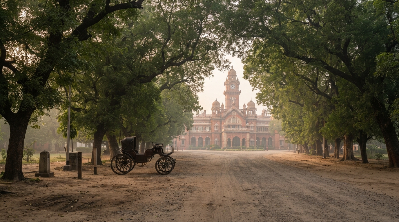
British administrators abandoned the integrated living patterns of the early nineteenth century. Instead, they built self-contained, low-density districts on the urban periphery. These settlements became known as Civil Lines. Understanding Civil Lines history India reveals how colonial anxieties shaped urban governance, architecture, and public health policies.
These spatial decisions permanently altered the Indian urban map. While walled cities retained their dense, pre-colonial layouts, British planners laid out sprawling, tree-lined grids just miles away. To understand how these administrative zones developed, we must look at the military, social, and epidemiological forces that drove nineteenth-century British town planning. You can explore our chronological guides on how to learn Indian history easily to see how these urban shifts fit into the broader imperial timeline.
The 1857 Uprising Reshaped Civil Lines History in India
The 1857 Indian Uprising was the decisive military catalyst that transformed Civil Lines history in India by ending European cohabitation with local populations. Following the rebellion, British military engineers established segregated civilian stations outside historic city walls to secure artillery lines, establish defensive esplanades, and isolate colonial magistrates from potential urban insurrections.
Military Defense and the Great Demolitions
Before 1857, East India Company officials frequently resided near or within walled cities like Delhi, Lucknow, and Agra. The 1857 rebellion demonstrated that dense urban streets favored local insurgencies over European cavalry and artillery. British regiments encountered severe tactical resistance while advancing through the constricted, winding alleys of Shahjahanabad and Lucknow.
After retaking control, the British Crown restructured urban geography around military defense. British authorities cleared an average perimeter of 450 to 500 yards of native housing around fortified centers like Delhi's Red Fort [Narayani Gupta, Delhi Between Two Empires, 1981 / 2021 reprint]. Planners turned these spaces into open firing fields called esplanades.
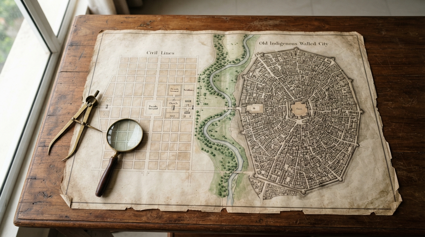
The state displaced thousands of residents to establish military dominance. This buffer ensured that rebel fighters could not approach colonial administrative centers unseen. Similar clearances took place in Lucknow and Kanpur, permanently altering the medieval fabric of North Indian cities.
+-------------------------------------------------------------------+
|               COLONIAL DUAL-CITY SPATIAL STRUCTURE                |
+-------------------------------------------------------------------+
|                                                                   |
|   +---------------------+                 +-------------------+   |
|   |  MILITARY CANTONMENT|                 |    CIVIL LINES    |   |
|   |  - Barracks         |                 |  - Bungalows      |   |
|   |  - Parade Grounds   |                 |  - District Court |   |
|   |  - Officers' Mess   |                 |  - European Club  |   |
|   +----------+----------+                 +---------+---------+   |
|              |                                      |             |
|              +------------------+-------------------+             |
|                                 |                                 |
|               =====================================               |
|               CORDON SANITAIRE / RAILWAY / ESPLANADE              |
|               =====================================               |
|                                 |                                 |
|                   +-------------+-------------+                   |
|                   |     WALLED NATIVE CITY    |                   |
|                   |     - High Density Bazaars|                   |
|                   |     - Mohallas & Havelis  |                   |
|                   |     - Indigenous Markets  |                   |
|                   +---------------------------+                   |
|                                                                   |
+-------------------------------------------------------------------+
The Physical Break from Old Walled Cities
The Crown took direct control of India in 1858 and began constructing designated civilian enclaves. In Civil Lines history India, this period marked the birth of the "Dual City" model. Planners created separate zones: the indigenous walled city, the military cantonment, and the civil station.
Between 1858 and 1910, British engineers instituted dual-city plans in over 60 major urban centers across the subcontinent [Urban History Association / Census of India historical data, 2022]. Civil Lines housed the civilian apparatus of empire. District magistrates, tax collectors, civil surgeons, and judges lived and worked in these isolated districts.
In Prayagraj (then Allahabad), the British moved the provincial capital from Agra in 1858. They built a massive Civil Lines zone based on a strict gridiron street network. The district featured institutional anchors like the Thornhill-Mayne Memorial, built in 1864, and the Mayo Memorial Hall. These stone monuments stood as permanent reminders of imperial permanence and administrative power.
Miasma Theory and Spatial Segregation Governed Colonial Urban Design
Miasma theory is the nineteenth-century epidemiological doctrine attributing infectious diseases like cholera and malaria to foul air generated by decaying matter. British colonial planners used miasma theory to justify strict spatial segregation, constructing Civil Lines on elevated ground with expansive green buffers and low population densities to insulate European personnel from indigenous urban settlements.
Cordons Sanitaires and Railway Boundaries
Colonial medical boards viewed native Indian settlements as centers of epidemic disease. British doctors believed in the "miasma theory" of contagion. This theory argued that diseases spread through noxious air generated by decaying matter and stagnant water.
Planners designed the layout of Civil Lines to prevent air from indigenous bazaars from reaching European homes. Colonial authorities built physical and ecological barriers called cordons sanitaires. These barriers included broad parks, racecourses, polo grounds, and public gardens.
+------------------------------------------------------------------+
|               EPIDEMIOLOGICAL CORDON SANITAIRE                   |
+------------------------------------------------------------------+
|                                                                  |
|   [Native Walled City]                                           |
|   High Density | Organic Layout | Bazaars                        |
|                                                                  |
|   ------------------------------------------------------------   |
|   BUFFER STRIP (400-800 Meters Wide)                             |
|   - Railway Lines and Yards                                      |
|   - Tree Belts, Botanical Gardens, and Racecourses               |
|   - Clear Military Firing Range (Esplanade)                      |
|   ------------------------------------------------------------   |
|                                                                  |
|   [Colonial Civil Lines]                                         |
|   Low Density | Gridiron Streets | Large Bungalow Lots           |
|                                                                  |
+------------------------------------------------------------------+
Railway lines served a dual purpose in this spatial strategy. Rail corridors moved troops and commercial cargo efficiently. The railway corridors also formed physical borders between native quarters and European enclaves.
In cities across the Gangetic plains, railway tracks split the urban landscape. European residential areas sat safely on one side of the tracks, while the indigenous population remained on the other. Crossing the railway meant moving between two entirely different administrative and sanitary worlds.
Density Disparities and the Spatial Hierarchy
The contrast in land use between Civil Lines and native cities was extreme. Colonial Civil Lines housed only 10 to 25 people per acre within large bungalow compounds. In contrast, adjacent native quarters like Old Delhi (Shahjahanabad) housed 300 to over 800 people per acre [Anthony D. King, Colonial Urban Development, 1976].
| Spatial Feature | Colonial Civil Lines | Indigenous Walled City |
|---|---|---|
| Average Population Density | 10–25 persons per acre | 300–800+ persons per acre |
| Street Layout | Geometric gridiron, 40–60 ft wide | Organic, winding alleys, 6–15 ft wide |
| Housing Typology | Single-family detached bungalows | Multi-story courtyard havelis, row houses |
| Average Plot Size | 1 to 5 acres | 50 to 500 square yards |
| Sanitary Infrastructure | Dedicated sweepers, open lawns | Shared open drains, communal wells |
| Primary Function | Imperial governance and recreation | Commerce, manufacturing, and family life |
Colonial municipal committees allocated tax revenues disproportionately. Municipal committees spent the majority of local road maintenance, lighting, and sanitation funds on the sparsely populated Civil Lines.
Walled cities received minimal civic upgrades despite generating most of the municipal taxes through trade duties. Urban sociologist Anthony D. King observed that this planning model reflected colonial political dominance rather than functional urban design. The low density of Civil Lines was an explicit expression of racial hierarchy and administrative authority.
Bungalow Compounds and Grid Layouts Formed Administrative Enclaves
The colonial bungalow compound is the signature residential building typology of the Civil Lines, combining domestic space with imperial administrative segregation. These single-story dwellings featured expansive perimeter verandas, lofty ceilings, and detached service quarters set within one to five acres of enclosed grounds to maintain strict social and physical separation from the public.
The Anatomy of the Colonial Bungalow Compound
A colonial bungalow is a standardized single-story European residence adapted from the traditional Bengali bangla hut. British military and civil engineers transformed this indigenous form into an imperial dwelling featuring a raised masonry plinth, high ceilings, clerestory windows, and a wide perimeter veranda designed for climate control and spatial dominance.
The compound surrounding the bungalow was an insular ecosystem. Plots ranged from one to five acres, enclosed by low masonry walls or neatly clipped hedges. The interior layout placed the dining room and living room in the center, flanked by bedrooms with attached dressing rooms and bathrooms.
+--------------------------------------------------------------------+
|                TYPICAL COLONIAL BUNGALOW COMPOUND                  |
+--------------------------------------------------------------------+
|                                                                    |
|     +--------------------------------------------------------+     |
|     | Boundary Hedge / Perimeter Wall                        |     |
|     |                                                        |     |
|     |    [Kitchen / Cookhouse]        [Stables / Carriage]   |     |
|     |                                                        |     |
|     |                  +------------------+                  |     |
|     |                  | Deep Back Porch  |                  |     |
|     |         +--------+------------------+--------+         |     |
|     |         | Bed    |   Dining Room    | Bed    |         |     |
|     |         | Room   +------------------+ Room   |         |     |
|     |         |        |   Central Hall   |        |         |     |
|     |         +--------+------------------+--------+         |     |
|     |                  | Wide Front Porch |                  |     |
|     |                  +--------+---------+                  |     |
|     |                           |                            |     |
|     |                 [Sweeping Gravel Drive]                |     |
|     |                                                        |     |
|     |    [Servants' Quarters]               [Tennis Court]   |     |
|     |                                                        |     |
|     |                       (Main Gate)                      |     |
|     +----------------------------+---------------------------+     |
|                                  |                                 |
|                       Broad Avenue / Mall Road                     |
+--------------------------------------------------------------------+
Kitchens, stables, and servants' quarters stood at the rear of the compound, completely detached from the main house. This layout isolated European families from cooking smells, heat, and direct contact with domestic laborers. High ceilings and clerestory windows allowed hot air to rise and escape, while manual punkhas (suspended fabric fans) cooled the interior rooms. For a deeper look at the evolution of these colonial domestic spaces, read our guide on colonial architecture in India.
Historian Thomas R. Metcalf noted that the nineteenth-century colonial bungalow functioned as a theater of authority. The vast physical distance between the main road and the bungalow's front porch kept ordinary Indian citizens away from colonial administrators. The compound architecture made the district magistrate an inaccessible figure of state authority.
Mall Roads, Clubs, and Administrative Hubs
Civil Lines featured a standardized network of municipal and recreational infrastructure. Broad, tree-lined roads connected the residential quarters to administrative offices. The primary artery in these settlements was almost always named the "Mall Road."
Colonial planners laid out Mall Roads with generous widths, often measuring 40 to 60 feet across. Planners planted shaded neem, banyan, and tamarind trees along the verandas and road edges. Mall Roads functioned as exclusive corridors for European evening promenades, carriage rides, and military movement.
Key institutions anchored life within every Civil Lines:
- The District Collectorate and Court: Built in classical or Indo-Saracenic styles, housing the district magistrate, revenue collectors, and judicial clerks.
- The European Club: An exclusive social institution that strictly banned Indian members until the mid-twentieth century.
- The Garrison or Anglican Church: Gothic Revival stone churches positioned near the center of the civil station to serve British residents.
- The Circuit House and Dak Bungalow: Staging facilities for visiting imperial inspectors, engineers, and traveling district magistrates.
- The Gymkhana and Racecourse: Sprawling sports complexes dedicated to polo, cricket, tennis, and equestrian events.
Civil Lines and Military Cantonments Split British Administration
While Civil Lines and cantonments often bordered one another, they operated under entirely different legal frameworks and administrative hierarchies. Cantonments served as military garrisons managed by army boards under martial regulations, whereas Civil Lines housed civilian bureaucrats, judiciary staff, and district administrators governed by civilian municipal committees.
+-----------------------------------------------------------------+
|               IMPERIAL GOVERNANCE AND URBAN DUALITY             |
+-----------------------------------------------------------------+
|                                                                 |
|   COLONIAL ADMINISTRATION                                       |
|   |                                                             |
|   +---> MILITARY CANTONMENT                                     |
|   |     - Governed by: Military Cantonment Acts (1864, 1924)    |
|   |     - Administered by: Station Commander / Cantonment Board |
|   |     - Inhabitants: British & Sepoy Regiments, Officers      |
|   |     - Core Layout: Barracks, Parades, Quarterguards         |
|   |                                                             |
|   +---> CIVIL LINES                                             |
|         - Governed by: Provincial Municipalities Acts           |
|         - Administered by: District Magistrate / Civil Comm.    |
|         - Inhabitants: Civilian Bureaucrats, Judges, Doctors    |
|         - Core Layout: Bungalows, Courts, European Clubs        |
|                                                                 |
+-----------------------------------------------------------------+
Military Rule Versus Civil Bureaucracy
British colonial town planning divided European settlements into military and civil halves. Cantonments were permanent military stations established under the Cantonment Acts of 1864, 1880, and 1924. They fell under the direct jurisdiction of the military station commander and cantonment magistrate. Land inside cantonments belonged entirely to the military, and residents lived there under strict military leases.
Civil Lines, by contrast, answered to the civilian government of the province. The District Magistrate or Deputy Commissioner presided over the local municipal committee. Land tenure in Civil Lines allowed long-term leases and eventual private ownership, giving civilian officers and merchants stable property rights.
In Kanpur, this division shaped the entire city. Kanpur became a major military garrison and the industrial manufacturing center of northern India. The cantonment housed British regiments and cavalry units.
The Kanpur Civil Lines housed factory owners, leather merchants, and district administrators. Planners located these homes upwind from the industrial tanneries and cotton textile mills. This kept European residents separated from both military barracks and the industrial workforce.
The Administrative Core in Major Colonial Cities
Different Indian cities adapted the Civil Lines model to fit their local political geography. In North Delhi, the Civil Lines served as the administrative headquarters of British India after the 1857 revolt. Senior administrators lived there until the inauguration of New Delhi in 1931.
Delhi's Civil Lines hosted the Imperial Durbars of 1877, 1903, and 1911. The district featured historic sites such as the Old Secretariat, the Maiden's Hotel, and British estates along the Delhi Ridge. The Delhi Ridge acted as a natural stone rampart, providing both recreation and a defensive barrier against the plains.
In Nagpur, the geographic center of the subcontinent, the Civil Lines housed the administrative core of the Central Provinces. The British built large stone secretariats and garden bungalows across the city's elevated basalt plateau.
These urban developments unfolded alongside major events covered across historic dates in modern India. The spatial patterns set in Delhi, Nagpur, and Kanpur established a standardized design language that municipal boards replicated across British India.
Post-Independence Urban Growth Strained Historic Civil Lines Zones
Following Indian independence in 1947, Indian civil servants, politicians, and business leaders moved into colonial Civil Lines, preserving their elite status. However, rapid twenty-first-century urbanization has placed extreme pressure on these historic districts, sparking continuous legal and planning conflicts between commercial redevelopment and architectural heritage conservation.
+------------------------------------------------------------------+
|               EVOLUTION OF CIVIL LINES LAND USE                  |
+------------------------------------------------------------------+
|                                                                  |
|   1860–1920: COLONIAL ERA                                        |
|   - Exclusively European civilian bureaucrats                    |
|   - Plot sizes: 1 to 5 acres; residential & administrative only  |
|                                                                  |
|   1920–1950: INDIGENOUS TRANSITION                               |
|   - Indian merchants, lawyers, and civil servants purchase plots |
|   - Adoption of colonial bungalow architecture by local elites   |
|                                                                  |
|   1950–1990: POST-INDEPENDENCE GOVERNANCE                        |
|   - Official residences for IAS, IPS officers, and Ministers     |
|   - Strict preservation of low-density Floor Area Ratios (FAR)   |
|                                                                  |
|   2000–PRESENT: COMMERCIAL INFILL & CONSERVATION CONFLICTS       |
|   - Infill pressure: Shopping malls, hotels, high-density towers |
|   - Heritage bylaws battle commercial redevelopment              |
|                                                                  |
+------------------------------------------------------------------+
Indian Elite Infill in the Early Twentieth Century
The racial exclusivity of Civil Lines began breaking down decades before 1947. By the 1920s, wealthy Indian merchants, high court advocates, and senior members of the Indian Civil Service began purchasing properties in Civil Lines. These buyers adopted the domestic architecture of the colonial ruling class.
Prominent Indian families built their own interpretations of the colonial bungalow. They incorporated neoclassical pediments, wide porticos, and expansive gardens into their homes. In Prayagraj, prominent political families built grand residences in Civil Lines, turning the neighborhood into an intellectual center for the Indian freedom movement.
When the British departed in 1947, the newly formed Indian Administrative Service (IAS) and Indian Police Service (IPS) inherited the colonial administrative footprint. District Magistrates, Divisional Commissioners, and High Court judges moved directly into the historic bungalows of their British predecessors. The state maintained the colonial low-density layout intact.
Contemporary Master Plans and Conservation Battles
Today, historic Civil Lines face intense redevelopment pressures across Tier-1 and Tier-2 Indian cities. Surrounding metropolitan areas have expanded rapidly, turning these once-peripheral enclaves into prime real estate in central urban locations.
In Tier-2 cities like Prayagraj, Bareilly, and Kanpur, commercial developers have bought and cleared many historic bungalow compounds. They replaced them with multi-story shopping complexes, private hospitals, and apartment towers [Local Municipal Town Planning Surveys, 2024–2026]. This commercial infill strains old colonial sewer networks, narrow access lanes, and local electrical grids.
+---------------------------------------------------------------+
|             MODERN CIVIL LINES POLICY TRADEOFFS               |
+---------------------------------------------------------------+
|                                                               |
|   HERITAGE CONSERVATION           URBAN DENSIFICATION         |
|   - Preserves 19th-century        - Unlocks prime downtown    |
|     bungalow architecture           land for housing          |
|   - Protects urban green canopy   - Reduces long-distance     |
|     and biodiversity corridors      suburban commuting        |
|   - Maintains historic memory     - Accommodates modern       |
|     and civic character             commercial growth         |
|                                                               |
|   CRITICAL TRADEOFF:                                          |
|   Enforcing colonial-era low-density caps (FAR 0.5–1.0)       |
|   protects green spaces, but limits central housing supply    |
|   and accelerates car-dependent urban sprawl at the periphery.|
+---------------------------------------------------------------+
The Delhi Development Authority maintains strict developmental protections across North Delhi's Civil Lines under its Master Plan for Delhi (MPD) framework [Delhi Development Authority, 2021/2026]. These regulations cap Floor Area Ratios (FAR) and restrict building heights to protect the historic green cover near the Delhi Ridge.
Preserving these low-density rules creates a significant urban planning tradeoff. While conservation protects architectural heritage and urban green cover, it severely restricts housing supply in central urban locations.
The Ministry of Culture has addressed this challenge using public-private partnership (PPP) conservation frameworks [Ministry of Culture, GoI, 2026]. These models invite corporate CSR funding and conservation architects to restore colonial-era civic buildings.
These programs adapt historic landmarks for modern public use while safeguarding them from unregulated demolition. To see how these colonial developments compare with earlier Indian urban traditions, explore our timeline of subcontinent history during the medieval era.
Frequently Asked Questions
Q: Why were colonial residential districts named "Civil Lines"?
The term "Civil Lines" distinguished the civilian administrative quarters from military "Cantonments" or "Cavalry Lines." The name designated the physical boundary and housing grid reserved for members of the uncovenanted and covenanted civil service, district judges, civil surgeons, and revenue collectors.
Q: How did Civil Lines differ from military cantonments in British India?
Civil Lines housed civilian bureaucrats and fell under municipal law, while cantonments housed armed troops under direct military jurisdiction and the Cantonment Acts. Cantonments featured barracks, parade grounds, and arsenals, whereas Civil Lines contained residential bungalows, district courts, treasury offices, and social clubs.
Q: Which Indian city had the first official Civil Lines?
Delhi, Kanpur, and Allahabad (now Prayagraj) developed some of the earliest formal Civil Lines after the British Crown took over governance following the 1857 uprising. Allahabad's Civil Lines, planned on a strict gridiron system in 1858 after the city became the provincial capital, became a standard model for colonial planners across northern India.
Q: What architectural style defined the houses built in Civil Lines?
The standard dwelling was the colonial bungalow, a single-story residence adapted from traditional Bengali cottages. These homes featured high ceilings, brick plinths, deep verandas, flat or thatched roofs, and detached kitchens and servants' quarters, all set inside one to five acres of landscaped grounds.
Your Next Move
If you are researching Indian urban history or preparing for competitive examinations, map the dual-city footprint of your nearest historic district. Compare the municipal boundary lines, street grid widths, and property zoning rules of the colonial Civil Lines against the adjacent historic walled quarters to see how nineteenth-century town planning still shapes modern Indian real estate and civic policy.
Related Reading
- India at the Olympics: A Timeline of Historic Sporting Milestones
- Milestones in Indian Women's History: A Chronological Guide
- 1,000 Years of Indian Medical History: A Chronological Guide
- Economic Milestones in Indian History: From 1947 to Present
Sources
- Delhi Between Two Empires, 1803–1931: Society, Government and Urban Growth — Oxford University Press, 1981. Supports: The British clearance of a 450- to 500-yard perimeter of native housing around Delhi's Red Fort following the 1857 rebellion to create defensive military esplanades.
- Colonial Urban Development: Culture, Social Power and Environment — Routledge, 1976. Supports: The stark population density disparity between low-density colonial Civil Lines (10–25 persons per acre) and dense indigenous quarters like Shahjahanabad (300–800+ persons per acre).
- An Imperial Vision: Indian Architecture and Britain's Raj — University of California Press, 1989. Supports: The analysis of the colonial bungalow and compound architecture as instruments of administrative authority and deliberate spatial detachment.
- Master Plan for Delhi — Delhi Development Authority, 2021. Supports: Development regulations and Floor Area Ratio (FAR) controls designed to preserve the low-density green character of North Delhi's Civil Lines Bungalow Area.
- The Cantonments Act, 1924 — Legislative Department, Ministry of Law and Justice, Government of India, 1924. Supports: The legal separation of military cantonments under armed forces station commanders from civilian municipal administrations.