From Madras Presidency to Tamil Nadu: A Historical Timeline
TL;DR
The Madras Presidency history timeline is the chronological transformation of a British colonial administrative province established in 1639 into the modern linguistic state of Tamil Nadu in 1969. Following Indian independence in 1947, linguistic state reorganisations between 1953 and 1956 reduced the multilingual territory, culminating in the official renaming on January 14, 1969.
Key Takeaways
- Colonial Madras Presidency spanned 159,798 square miles across five modern Indian states.
- The 1921 Communal Government Order established India's first affirmative action quotas.
- Linguistic protests split Andhra in 1953 and redrew southern borders in 1956.
- The territory shrank from 26 colonial districts down to 13 state districts.
- Parliament passed the renaming act in 1968, taking effect in January 1969.
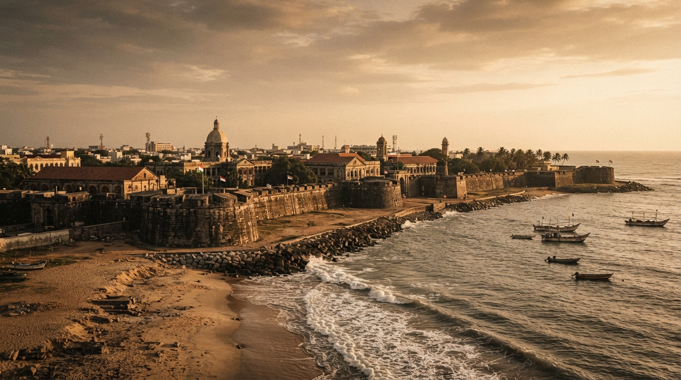
A visitor walking past the red brick walls of Fort St. George in Chennai encounters a fortress built in 1639. The surrounding province once stretched from the southern tip of the subcontinent to the borders of Odisha. Today, that colonial territory is gone.
Studying the Madras Presidency history timeline reveals how a British administrative unit transformed into a linguistic state. Understanding this process helps readers who use an Indian history timeline chart to grasp modern regional boundaries. The transformation required decades of administrative reforms, public agitations, and legislative debates.
How Did the Madras Presidency Form Under Colonial Rule?
The Madras Presidency began as a fortified British trading settlement along the Coromandel Coast before expanding through military conquest. Between 1639 and 1801, the East India Company acquired territories from local rulers through treaties and the Anglo-Mysore and Carnatic Wars, creating a sprawling multilingual administrative province.
The 1639 Grant and Fort St. George
The 1639 grant is the foundational charter secured on August 22, 1639, by East India Company factors Francis Day and Andrew Cogan from the Nayak rulers of Chandragiri for coastal land in Madraspatnam. On this territory, the East India Company constructed Fort St. George to protect its maritime textile trade.
Fort St. George served as the headquarters for English operations along the Bay of Bengal. By 1684, the East India Company elevated the agency to the status of Madras Presidency. This administrative post operated under a Governor and Council.
Initial trade centered on calico cloth, silk, and spices. Over the next century, commercial operations grew into political ambitions.
Expansion Across South India (1750–1801)
The mid-eighteenth century brought military conflict across the Carnatic region. French and British forces fought three successive Carnatic Wars between 1746 and 1763. British victories pushed French influence out of southern India.
The Company also fought four Anglo-Mysore Wars between 1767 and 1799. The defeat of Tipu Sultan in 1799 gave the British direct control over Coimbatore, Salem, and the Kanara districts.
In 1801, the Nawab of Arcot ceded the administrative territories of the Carnatic to the British through treaty agreements. These acquisitions linked coastal and inland territories together. The newly formed Madras Presidency established its borders across southern India.
1639: Madraspatnam grant acquired by Francis Day
  │
1684: Fort St. George elevated to Madras Presidency
  │
1746–1763: Carnatic Wars eliminate French influence
  │
1799: Defeat of Tipu Sultan adds Western Tamil regions
  │
1801: Treaty of Carnatic cements colonial boundaries
The Administrative Monolith and Ryotwari System
At its height, the Madras Presidency covered 159,798 square miles [The Hindu, 2025]. It included parts of modern Tamil Nadu, Andhra Pradesh, Karnataka, Kerala, and Odisha.
Historian Sriram V. noted that the Presidency functioned as an administrative monolith that grouped distinct linguistic populations under a single governing body [The News Minute, 2018]. The population expanded from 13,476,923 in the 1822 enumeration to 49,341,810 in the 1941 Census [Census of India / Directorate of Census Operations, 1941].
Presidency Population Growth:
1822: ███ 13.47 Million
1941: ██████████ 49.34 Million
Governor Thomas Munro introduced the Ryotwari land revenue system in the 1820s. Unlike the Zamindari system used in Bengal, the Ryotwari system collected revenue directly from individual peasants.
Collectors surveyed every plot of land and fixed tax rates based on soil productivity. This administrative structure required detailed village-level recordkeeping. It defined southern rural administration for over a century.
Key Milestones in the Madras Presidency History Timeline
The Madras Presidency history timeline during the early twentieth century centered on social justice legislation, representative governance, and linguistic identity movements. The rise of the non-Brahmin movement and constitutional reforms reshaped the region's political framework between 1920 and 1947.
1920: Non-Brahmin Justice Party takes office
  │
1921: Communal Government Order introduces reservations
  │
1937: Indian National Congress wins provincial elections
  │
1947: Independence initiates state reorganization debates
The 1921 Communal Government Order and Justice Party Governance
The South Indian Liberal Federation, commonly known as the Justice Party, won the first legislative council elections held under the Government of India Act 1919. They took office in December 1920.

The Justice Party challenged elite dominance within the administrative civil service. On September 16, 1921, the government issued the historic Communal Government Order (G.O. No. 613).
This order introduced the first official quota system for government employment in British India. It distributed administrative posts across five categories:
- Non-Brahmin Hindus
- Brahmins
- Muslims
- Anglo-Indians and Indian Christians
- Depressed Classes (Scheduled Castes)
The policy altered the composition of the provincial civil service. It established an administrative tradition of affirmative action that remains central to modern regional policy.
The 1941 Census and Demographics of a Multilingual Territory
The 1941 Census of the Madras Presidency is the colonial demographic survey that recorded 49,341,810 residents across five distinct linguistic groups within provincial boundaries [Census of India / Directorate of Census Operations, 1941]. Tamil and Telugu speakers formed the two largest linguistic blocs alongside Malayalam, Kannada, and Odia populations.
Language barriers complicated education policy and tax collection across the province's 26 districts. Non-Tamil linguistic groups regularly argued that public expenditures favored the capital city of Madras at the expense of outlying districts. These economic and cultural divisions fueled calls for administrative separation.
Provincial Autonomy and the 1937 Elections
The Government of India Act 1935 expanded the provincial voting franchise and granted greater regional autonomy. In the 1937 Madras Legislative Assembly elections, the Indian National Congress defeated the Justice Party.
C. Rajagopalachari became the Premier of the Madras Presidency. His administration introduced prohibition, temple entry rights for Dalits, and sales taxes.
His decision to make Hindi a compulsory subject in secondary schools in 1938 sparked massive anti-Hindi protests across Tamil districts. Periyar E.V. Ramasamy and other Dravidian leaders coordinated large public demonstrations.
The protests forced the government to drop the policy in 1940. This political mobilization reinforced regional linguistic identity over central mandates. Readers looking to trace these shifts can consult our guide on how to learn Indian history easily through chronological timelines.
What Triggered the Partition of Madras State After 1947?
Linguistic nationalism after 1947 dismantled the colonial-era boundaries of Madras State. Demands for separate regional administrations led to fatal hunger strikes, commissions on state reorganization, and territorial transfers with neighboring states between 1953 and 1956.
1952: Potti Sreeramulu's 58-day fast leads to Andhra State
  │
1953: Northern Telugu districts separate from Madras State
  │
1956: States Reorganisation Act aligns southern state borders
Potti Sreeramulu and the Creation of Andhra State (1953)
Telugu leaders had demanded a separate Andhra province since the early twentieth century. After independence, the central government delayed redrawing internal borders, fearing it might weaken national unity.
On October 19, 1952, Gandhian activist Potti Sreeramulu began an indefinite hunger strike in Madras. He demanded a separate state for Telugu-speaking people, with Madras as its capital.
His fast lasted 58 days until his death on December 15, 1952. Widespread civil unrest broke out across coastal Andhra.
Prime Minister Jawaharlal Nehru conceded to the demand. On October 1, 1953, the central government created Andhra State out of 11 northern districts of Madras State. Madras city remained the capital of the downsized Madras State.
The States Reorganisation Act of 1956
The creation of Andhra State prompted calls for complete linguistic reorganization across the entire country. The central government appointed the States Reorganisation Commission (SRC) under Justice Fazal Ali in December 1953 to examine boundary questions.
The Indian Parliament passed the States Reorganisation Act, 1956 based on the commission's findings [Madras State Archives / Union Government of India, 1956]. The act took effect on November 1, 1956.
It systematically aligned provincial borders with dominant language zones:
- Malabar District Transfer: Transferred Malabar District and the Kasaragod taluk to the newly created state of Kerala.
- Canara and Bellary Adjustments: Moved South Canara district and Kollegal taluk to Mysore State (later Karnataka).
- Island Reallocation: Transferred the Laccadive, Minicoy, and Amindivi Islands out of Madras State administration to form a new Union Territory.
- Southern Additions: Added the Tamil-majority taluks of Agastheeswaram, Thovalai, Kalkulam, and Vilavancode, along with Shencottah, from Travancore-Cochin to Madras State.
The Southern Border Agitation in Kanyakumari
While northern districts formed Andhra, the southern border saw its own civil agitation. The Travancore Tamil Nadu Congress (TTNC), led by A. Nesamony, fought for the merger of Tamil-speaking regions of southern Travancore into Madras State.
Protests turned violent in August 1954 when police opened fire on demonstrators in Marthandam and Puthukadai. Several activists were killed during these clashes.
The SRC recognized that these taluks contained an overwhelming Tamil majority. On November 1, 1956, the southern territory was organized as Kanyakumari district and added to Madras State. This finalized the state's southern boundary at Cape Comorin.
Evolution of Borders: Madras Presidency to Tamil Nadu
The border evolution from Madras Presidency to Tamil Nadu is the territorial reorganization process that reduced a multilingual colonial province of 159,798 square miles into a unilingual state of approximately 50,216 square miles. This restructuring occurred primarily through the Andhra State Act 1953 and the States Reorganisation Act 1956.
Presidency Peak (1911):  26 Districts (159,798 sq. mi.)
Madras State (1956):      13 Districts (50,216 sq. mi.)
Tamil Nadu Today:        38 Districts
Territorial Shrinkage and District Reorganisation
The territorial footprint of the administration dropped sharply between 1911 and 1956. The colonial Presidency maintained 26 districts spanning five language zones [BrainKart / Tamil Nadu School Education, 2021].
Following the 1956 linguistic reorganization, Madras State retained just 13 districts. The total land area dropped from 159,798 square miles to roughly 50,216 square miles.
This geographic reduction concentrated the government's focus on Tamil-majority areas. Over the following decades, the state divided large historical districts like Salem, North Arcot, and Thanjavur to improve local governance. Today, Tamil Nadu contains 38 districts.
Modern Administrative Comparison Table
The following table outlines how the administration evolved across different eras:
| Dimension | Madras Presidency (1941) | Madras State (1956) | Tamil Nadu (Present Day) |
|---|---|---|---|
| Total Area | 159,798 sq. miles | ~50,216 sq. miles | ~50,216 sq. miles (130,058 km²) |
| Total Population | 49,341,810 (1941 Census) | ~30,119,000 (1956 Est.) | 72,147,030 (2011 Census) |
| Number of Districts | 26 districts | 13 districts | 38 districts |
| Primary Languages | Tamil, Telugu, Malayalam, Kannada, Odia | Tamil (Dominant), English | Tamil, English |
| Administrative Center | Fort St. George, Madras | Fort St. George, Madras | Fort St. George, Chennai |
| Governing Statute | Government of India Act 1935 | Constitution of India (7th Amendment) | Constitution of India |
The Divergence of South Indian State Borders
Colonial provinces grouped territories together based on military conquest and revenue lines rather than local language or culture.
The post-1956 realignment produced four distinct linguistic states in southern India: Tamil Nadu, Andhra Pradesh, Kerala, and Mysore (later Karnataka).
Administrative files and survey records previously held at Fort St. George were split between state archives. This administrative separation allowed each state to build localized education, irrigation, and agricultural policies.
How Did Madras State Officially Become Tamil Nadu?
Renaming the state required years of public protests, a fatal hunger strike, and two separate legislative actions. The state assembly passed a resolution in 1967, and the central Parliament passed the necessary constitutional act in 1968, making the name official on January 14, 1969.
1956: Sankaralinganar's 76-day fast demands the name "Tamil Nadu"
  │
1967: C.N. Annadurai moves historic renaming resolution in Assembly
  │
1968: Indian Parliament passes Madras State (Alteration of Name) Act
  │
1969: "Tamil Nadu" becomes the official legal name on Pongal day
Sankaralinganar’s 76-Day Hunger Strike (1956)
While the central government reorganized state borders by language, it kept the colonial name "Madras State." Gandhian activist K.P. Sankaralinganar began an indefinite fast in Virudhunagar on July 27, 1956.
He presented twelve demands to the government. His primary demand was renaming Madras State to "Tamil Nadu."
Leaders like C.N. Annadurai, M.P. Sivagnanam, and K. Kamaraj visited him and urged him to end the fast. Sankaralinganar refused to break his hunger strike without an official government commitment.
His condition worsened, and he died on October 13, 1956, after fasting for 76 days [The News Minute, 2018]. His sacrifice made the renaming campaign a central issue in regional politics.
The Historic Assembly Resolution of July 18, 1967
The Dravida Munnetra Kazhagam (DMK) won the Madras Legislative Assembly election in 1967, and C.N. Annadurai took office as Chief Minister.
On July 18, 1967, Annadurai moved a formal resolution in the Assembly to rename Madras State as Tamil Nadu. He cited classical Sangam literature, including the Silappadhikaram and Tolkappiyam, showing that the name had documented historical roots dating back over two millennia [The News Minute, 2018].
The resolution passed unanimously across all parties in the state legislature. Today, the debate over when to celebrate statehood persists:
- July 18: Observed by the state government as "Tamil Nadu Day" to mark the 1967 legislative resolution [Deccan Chronicle, 2026].
- November 1: Backed by opposition parties to mark the 1956 linguistic reorganization date [The Hindu, 2021].
The Madras State (Alteration of Name) Act of 1968
A state assembly resolution cannot change a state's name on its own. The Indian Constitution requires the central Parliament to amend the First Schedule under Article 3 and Article 4.
The Parliament passed the Madras State (Alteration of Name) Act, 1968 (Act No. 53 of 1968) [Ministry of Law and Justice, 1968].
The central law took effect on January 14, 1969, coinciding with the Pongal harvest festival. Annadurai addressed the state, declaring the name change a restoration of regional identity within the Indian Union.
Those interested in broader national milestones can explore our archive on what are the major events in Indian history.
Legal Mechanism for Renaming:
1. State Assembly Resolution (July 18, 1967)
   ↓
2. Parliamentary Legislation (Act No. 53 of 1968)
   ↓
3. First Schedule Constitutional Amendment (January 14, 1969)
Frequently Asked Questions
Q: When was the Madras Presidency created?
The East India Company established the agency at Fort St. George in 1639. It elevated the territory to the status of a Presidency in 1684 under a Governor and Council. The province reached its full borders by 1801 following the Carnatic treaties.
Q: Why was the Madras Presidency divided into multiple states?
The Presidency was a multilingual administrative unit formed through colonial conquest. After 1947, linguistic groups demanded separate administrative states to manage education, commerce, and governance in their native languages. These demands led to the creation of Andhra in 1953 and the linguistic reorganization of 1956.
Q: What is the difference between Madras State and Tamil Nadu?
Madras State was the official name used by the Indian Constitution between 1950 and 1969 for the downsized territory. Tamil Nadu is the official name adopted on January 14, 1969, following the passage of the Madras State (Alteration of Name) Act, 1968.
Q: Who went on a hunger strike to rename Madras State?
Gandhian activist K.P. Sankaralinganar went on a 76-day hunger strike starting July 27, 1956. He died on October 13, 1956, after demanding that Madras State be renamed Tamil Nadu.
Q: When is Tamil Nadu Day celebrated?
The Tamil Nadu state government officially celebrates Tamil Nadu Day on July 18 to commemorate the 1967 Assembly resolution. Other political groups observe it on November 1, marking the 1956 linguistic reorganization of states.
Your Next Move
A study framework for the Madras Presidency history timeline is a chronological method that organizes regional historical milestones into colonial expansion (1639–1801), linguistic partition (1953–1956), and constitutional renaming (1967–1969). Researchers should consult primary sources like the 1921 Communal Government Order and the Madras State (Alteration of Name) Act, 1968 for verified legislative evidence.
Related Reading
- Indian History Timeline Chart: Key Milestones (Digital Reference)
- India at the Olympics: A Timeline of Historic Sporting Milestones
- Indian History Milestones: The Maurya and Gupta Empires
- Milestones in Indian Women's History: A Chronological Guide
Sources
- The Madras State (Alteration of Name) Act, 1968 — Parliament of India / Indian Kanoon, 1968. Supports: The enactment of Act No. 53 of 1968 by the Indian Parliament and its coming into force on January 14, 1969, to legally rename Madras State to Tamil Nadu.
- The States Reorganisation Act, 1956 — Parliament of India / Indian Kanoon, 1956. Supports: The linguistic reorganisation of southern India in 1956, transferring Malabar, South Canara, and allocating Tamil-majority taluks of Travancore-Cochin to Madras State.
- 50 years on, a look at how Madras State became Tamil Nadu — The News Minute, 2018. Supports: K.P. Sankaralinganar's 76-day fatal hunger strike in 1956 and the historic legislative renaming push led by C.N. Annadurai.
- July 18 to be observed as Tamil Nadu Day — The Hindu, 2021. Supports: The state government's observance of July 18 as Tamil Nadu Day to mark the 1967 legislative resolution compared to the November 1 linguistic reorganization date.
- Tributes paid to Potti Sreeramulu — The Hindu, 2026. Supports: Potti Sreeramulu's 58-day hunger strike that led to the bifurcation of Madras State and the creation of Andhra State in 1953.