Historic Statehood Dates: A Timeline of Kerala and Assam's Formation

The Quick Read
Kerala and Assam statehood history is the account of two contrasting models of Indian federal reorganization under Article 3 of the Constitution of India. Kerala formed on November 1, 1956, by consolidating Malayalam-speaking territories under the States Reorganisation Act of 1956, whereas Assam attained Part A statehood on January 26, 1950, before subsequent parliamentary acts bifurcated its frontier districts.
Key Takeaways
- Kerala integrated three distinct regions into one unified linguistic state on November 1, 1956.
- Assam gained Part A constitutional statehood on January 26, 1950, following British colonial annexation in 1826.
- Four separate states were carved out of undivided post-independence Assam between 1963 and 1987.
- Kerala conceded five southern taluks to Madras State while acquiring the northern district of Malabar.
- Contemporary reforms include border settlements in Assam and constitutional renaming initiatives for Kerala.
Archival boundary maps from the Survey of India in 1948 display two drastically different border landscapes. On the southwestern coast, cartographers drew dashed lines separating the princely states of Travancore and Cochin from the British-ruled Madras Presidency. Thousands of kilometers to the northeast, maps showed the sprawling territory of Assam extending across broad river plains and rugged frontier tracts. Exploring Kerala and Assam statehood history shows how India used federal restructuring to balance distinct regional demands. One state formed by bringing scattered linguistic communities together under a single administration. The other state served as an administrative parent from which multiple distinct hill states emerged. These divergent paths reveal the flexibility of Article 3 of the Indian Constitution during the post-independence era.
How Did Colonial Treaties and Princely States Shape Kerala and Assam Before 1947?
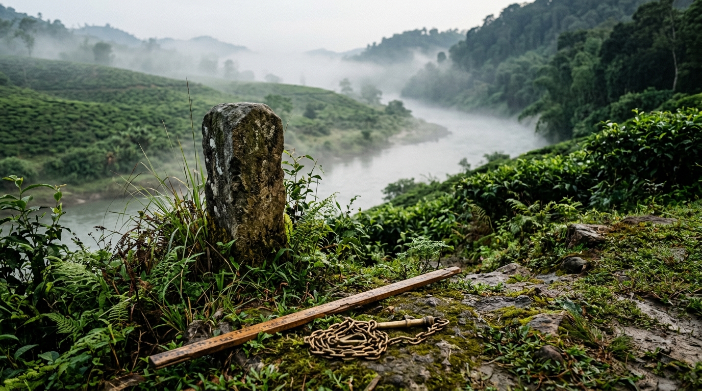
Pre-1947 territorial governance in Kerala and Assam is the colonial administrative system established through military conquests, commercial pacts, and subsidiary treaties across British India. On the southwestern coast, the British East India Company partitioned Malayalam-speaking lands between the directly ruled Malabar District of the Madras Presidency and the internally autonomous princely states of Travancore and Cochin under British residents. In contrast, British authorities consolidated the northeastern frontier by directly annexing the Brahmaputra Valley through the 1826 Treaty of Yandabo following the First Anglo-Burmese War. The colonial government later created the Chief Commissioner's Province of Assam in 1874, combining the Brahmaputra plains, surrounding tribal hill tracts, and the Bengali-majority district of Sylhet. Consequently, pre-independence southwestern governance remained fragmented among distinct monarchies and colonial presidencies, while northeastern governance functioned as a single sprawling province encompassing diverse ethnic communities.
The Treaty of Yandabo and British Expansion in Assam (1826)
British intervention in Assam started as a military response to Burmese territorial expansion. The Burmese Empire invaded the Brahmaputra Valley multiple times between 1817 and 1821, destabilizing the six-century-old Ahom dynasty. This regional instability threatened British commercial interests along the eastern frontier of Bengal.
The First Anglo-Burmese War concluded on February 24, 1826, with the signing of the Treaty of Yandabo [Britannica, 2026]. Under Article 2 of the treaty, the King of Ava renounced all claims over Assam, Cachar, and Jaintia. This formal agreement transferred direct administrative authority over the Brahmaputra Valley to the British East India Company.
British administrators initially ran Assam as a division of the Bengal Presidency. The colonial government created the Chief Commissioner's Province of Assam in 1874 to manage tea production and regional trade. This administrative unit included the surrounding tribal hill tracts and the Bengali-majority district of Sylhet.
Princely Autonomy in Travancore and Cochin
Governance across the Malayalam-speaking southwest remained divided among distinct monarchies prior to independence. The Kingdom of Travancore in the south and the Kingdom of Cochin in the central region maintained separate political structures. Both states signed subsidiary alliance treaties with the British East India Company around the turn of the nineteenth century.
These treaties allowed the royal dynasties to handle domestic governance while ceding external defense and foreign relations to British residents. Travancore developed an organized revenue administration and invested in public infrastructure. Cochin built an active port economy centered around trade networks developed during the Portuguese era in Goa and the Malabar coast.
Neither princely state shared a formal administrative apparatus with the other. Travancore maintained its capital in Trivandrum, while Cochin governed from Tripunithura. Despite sharing cultural roots and the Malayalam language, their governments maintained independent legal codes, judicial systems, and tax structures.
+-------------------------------------------------------------------------+
|                  PRE-1947 REGIONAL CONFIGURATIONS                       |
+-------------------------------------------------------------------------+
|  SOUTHWEST (Future Kerala)              NORTHEAST (Undivided Assam)     |
|  - Travancore (Princely State)          - Brahmaputra Valley Districts  |
|  - Cochin (Princely State)              - Surma Valley (Sylhet, Cachar) |
|  - British Malabar (Madras Pres.)       - Excluded / Tribal Hill Tracts |
+-------------------------------------------------------------------------+
Early Administrative Boundaries and British Malabar
British Malabar is the northern administrative district of the Malayalam-speaking region that came under direct British East India Company rule following the Anglo-Mysore Wars. Under the 1792 Treaty of Seringapatam, Tipu Sultan ceded the Malabar territory to the Company, which annexed the district directly into the colonial Madras Presidency.
This administrative arrangement severed Malabar from traditional cultural ties with the southern princely states of Travancore and Cochin. Colonial district collectors governed Malabar from Calicut, enforcing Madras revenue regulations and land tenure systems that imposed distinct tax burdens and sparked recurring agrarian uprisings throughout the nineteenth century.
By the early twentieth century, Malayalam speakers remained divided across three separate political jurisdictions: British Malabar, the Kingdom of Cochin, and the Kingdom of Travancore. This territorial division fragmented regional commerce, public education, and legal proceedings until post-independence reorganisation merged the three territories under the States Reorganisation Act of 1956.
How Did Independence and Partition Alter the Borders of Kerala and Assam in 1947?
Independence forced sudden border shifts and diplomatic negotiations across both regions. Assam lost most of the Sylhet district to East Bengal following a referendum in July 1947. Simultaneously, the princely states of Travancore and Cochin integrated into the Indian Union, resisting separate sovereignty and initiating the unification process.
The Sylhet Referendum and Assam's Border Realignment (1947)
Assam faced immediate territorial reduction during the partition of British India in August 1947. The colonial province included the populous, Bengali-speaking district of Sylhet, which had strong cultural and geographic connections to East Bengal. Lord Mountbatten's partition plan mandated a popular vote to decide whether Sylhet would remain in Assam or join Pakistan.
The Sylhet Referendum took place on July 6 and 7, 1947. Official returns showed that 56.6% of voters, representing 239,619 ballots, chose separation to join East Bengal [1947 Partition Archive, 2024]. The Boundary Commission led by Sir Cyril Radcliffe subsequently drew the formal border.
SYLHET REFERENDUM RESULTS (JULY 1947)
+-------------------------------------------------------------+
| Option                         | Votes Cast   | Percentage  |
+--------------------------------+--------------+-------------+
| Join East Bengal (Pakistan)    | 239,619      | 56.6%       |
| Remain in Assam (India)        | 184,041      | 43.4%       |
+--------------------------------+--------------+-------------+
Source: 1947 Partition Archive Data
Radcliffe awarded three and a half thanas of the Karimganj subdivision to India, retaining them within Assam's Cachar district. The remainder of Sylhet transferred to Pakistan on August 15, 1947. This partition severed crucial rail connections and trade routes across the northeast.
The Aikya Kerala Movement and Princely Integration (1947–1949)
Linguistic unification campaigns gained momentum across the southwest as British rule ended. The Aikya Kerala (United Kerala) movement mobilized citizens, writers, and politicians to demand a unified administrative state. The landmark Aikya Kerala Convention took place in Thrissur in April 1947 [Mathrubhumi, 2024].
Chaired by K. Kelappan and inaugurated by Maharaja Kerala Varma of Cochin, the convention passed formal resolutions demanding the integration of Travancore, Cochin, and British Malabar. Political friction arose when Sir C.P. Ramaswami Iyer, the Diwan of Travancore, announced intentions to declare Travancore an independent sovereign state in June 1947.
Ramaswami Iyer argued that accession would compromise Travancore's economic autonomy and maritime revenue [ArmChair Journal, 2025]. Public protests and political negotiations organized by the Ministry of States quickly overturned this stance. Travancore acceded to the Indian Union in August 1947. On July 1, 1949, the two princely realms merged into the unified Part B State of Travancore-Cochin.
Constitutional Classifications of Part A and Part B States (1950)
The Constitution of India took effect on January 26, 1950, creating a four-tier classification system for Indian states. This structure recognized former British provinces, integrated princely states, and centrally administered territories under different constitutional schedules.
1950 CONSTITUTIONAL CLASSIFICATION
- Part A States: Former British provinces governed by elected governors (Assam, Madras, Bombay).
- Part B States: Integrated princely unions governed by a Rajpramukh (Travancore-Cochin, Mysore).
- Part C States: Chief Commissioner's provinces under central control (Coorg, Ajmer, Delhi).
- Part D States: Frontier territories and island groups (Andaman and Nicobar Islands).
Assam attained constitutional statehood as a Part A State on January 26, 1950 [Constitution of India, 1950]. This designation granted Assam an elected legislature and an executive headed by a governor. The state administered the Brahmaputra Valley, the hills of the Khasi, Jaintia, Garo, Lushai, and Naga communities, and the North-East Frontier Agency.
Travancore-Cochin became a Part B State on the same day. The Maharaja of Travancore served as the constitutional Rajpramukh, while an elected legislative assembly managed state legislation. British Malabar remained an administrative district inside the Part A State of Madras. This divided system set the stage for major federal reforms.
How Did the States Reorganisation Act of 1956 Establish Modern Kerala?
The States Reorganisation Act of 1956 dissolved existing Part B classifications to create Kerala on November 1, 1956. This reform merged the state of Travancore-Cochin with the Malabar district and Kasaragod taluk of Madras State, while transferring five southern Tamil-majority taluks to Madras State.
Recommendations of the Fazal Ali Commission (1955)
The Fazal Ali Commission is the three-member States Reorganisation Commission appointed by the Indian government in December 1953 to reorganize internal state boundaries along linguistic and administrative lines. Comprising Justice Fazal Ali, K.M. Panikkar, and H.N. Kunzru, the commission submitted its report in September 1955 recommending the creation of a unified Malayalam-speaking state [SRC Report, 1955].
The commission's 1955 report formally proposed dismantling the Part B State of Travancore-Cochin and merging its territory with the Malabar district and Kasaragod taluk of Madras State. The commission determined that unifying Malayalam-speaking populations under a single administration would improve regional governance and satisfy long-standing cultural demands.
The commission also recommended specific boundary adjustments along linguistic lines. Recognizing that the southern taluks of Travancore contained a Tamil-speaking majority that sought integration with Madras, the commission advised transferring those southern areas to Madras State while consolidating northern Malayalam-majority territories into the new state of Kerala.
Unification of Malabar, Kasaragod, and Travancore-Cochin (November 1, 1956)
Parliament implemented the commission's proposals by enacting the States Reorganisation Act of 1956 alongside the 7th Constitutional Amendment. On November 1, 1956, the new state of Kerala came into existence [States Reorganisation Act, 1956]. This milestone is celebrated annually across the region as Kerala Piravi (Kerala Day).
TERRITORIAL COMPOSITION OF KERALA (NOVEMBER 1, 1956)
+-----------------------------------+-----------------------------------+
| Region Added                      | Source Entity                     |
+-----------------------------------+-----------------------------------+
| Travancore-Cochin Core            | Part B State of Travancore-Cochin |
| Malabar District                  | Madras State (Part A)             |
| Kasaragod Taluk                   | South Kanara District (Madras)    |
+-----------------------------------+-----------------------------------+
| Region Transferred Out            | Destination Entity                |
+-----------------------------------+-----------------------------------+
| Agastheeswaram, Thovalai,         | Madras State (Tamil Nadu)         |
| Kalkulam, Vilavancode Taluks      |                                   |
| Shenkottai Taluk (Eastern Half)   | Madras State (Tamil Nadu)         |
+-----------------------------------+-----------------------------------+
The 1956 reorganisation merged the Malabar district and Kasaragod taluk of South Kanara district with Travancore-Cochin. It also removed the Laccadive, Minicoy, and Amindivi Islands from Malabar, placing them under direct central administration as a Union Territory.
The unified state covered approximately 38,863 square kilometers of land along the Arabian Sea. It brought together over 13.5 million Malayalam speakers under a single state assembly. These events represent one of the 10 most searched dates in Indian history regarding linguistic statehood movements.
Territorial Concessions: The Transfer of Southern Taluks
Creating Kerala required substantial territorial trade-offs along its southern and eastern borders. The Travancore Tamil Nadu Congress led persistent protests demanding that Tamil-majority areas separate from Travancore-Cochin. These demonstrations led to direct political negotiations during the boundary drafting process.
Under Section 4 of the States Reorganisation Act, the Indian government transferred five taluks to Madras State:
- Agastheeswaram
- Thovalai
- Kalkulam
- Vilavancode
- The eastern portion of Shenkottai
These four southern taluks formed the newly established Kanyakumari district in Madras State (now Tamil Nadu). The loss of Kanyakumari removed extensive agricultural acreage and historical royal monuments from the newly formed state. This trade-off resolved deep language-based political friction along the southern border.
How Did Reorganisation Devolution Divide Post-Independence Assam?
Assam underwent successive territorial divisions between 1963 and 1987 to resolve ethnic and tribal aspirations. Parliament passed dedicated reorganization legislation to separate distinct frontier tracts, creating Nagaland, Meghalaya, Mizoram, and Arunachal Pradesh from lands once administered directly or indirectly by the government in Shillong.
THE POST-INDEPENDENCE DEVOLUTION OF UNDIVIDED ASSAM
+-------------------------------------------------------------------------+
|                           UNDIVIDED ASSAM (1950)                        |
+-------------------------------------------------------------------------+
         |
         +--> Nagaland (Statehood: December 1, 1963)
         |
         +--> Meghalaya (Autonomous State: 1970; Full State: Jan 21, 1972)
         |
         +--> Mizoram (Union Territory: 1972; Full State: Feb 20, 1987)
         |
         +--> Arunachal Pradesh (NEFA -> UT: 1972; Full State: Feb 20, 1987)
         |
         v
  CONTEMPORARY ASSAM (Brahmaputra Valley, Barak Valley, Hill Councils)
Creation of Nagaland from Assam's Tribal Districts (1963)
Assam's early post-independence borders included vast mountainous tracts populated by distinct indigenous communities. The Naga National Council began demanding complete sovereignty in the late 1940s, asserting that Naga communities had never been part of historical Indian empires.
Armed conflict and political negotiations between moderate Naga leaders and Prime Minister Jawaharlal Nehru produced the 16-Point Agreement in 1960. This settlement provided for a separate administrative state within the Indian Union. Parliament enacted the State of Nagaland Act in 1962 to implement the agreement.
On December 1, 1963, Nagaland became the 16th state of the Indian Union. The new state absorbed the Naga Hills district of Assam and the Tuensang frontier division. This bifurcation marked the first territorial reduction of post-independence Assam under Article 3 of the Constitution.
The North-Eastern Areas Reorganisation Act of 1971
Demands for administrative autonomy grew among the hill tribes of the Garo, Khasi, and Jaintia ranges during the 1960s. The All Party Hill Leaders Conference campaigned for a separate hill state, arguing that Assam's official language policies marginalized non-Assamese tribal populations.
Parliament addressed these regional demands by passing the North-Eastern Areas (Reorganisation) Act in December 1971 [Legislative Department, 1971]. This statute restructured the administrative framework of northeast India, coming into full legal effect on January 21, 1972.
The 1971 act created two new full states and two union territories from Assam's administrative sphere:
- Meghalaya gained full statehood by combining the United Khasi-Jaintia Hills and the Garo Hills.
- The Mizo Hills district separated from Assam to become the Union Territory of Mizoram.
- The North-East Frontier Agency was renamed Arunachal Pradesh and organized as a Union Territory.
- Assam relocated its state capital from Shillong to Dispur, a neighborhood of Guwahati.
Subsequent Statehood Milestones for Meghalaya, Mizoram, and Arunachal Pradesh
The territories carved out in 1972 continued their administrative evolution over the following two decades. The central government signed the Mizoram Peace Accord in 1986, ending two decades of insurgency in the Mizo Hills. Parliament passed the State of Mizoram Act, elevating the territory to full statehood on February 20, 1987.
Arunachal Pradesh attained full statehood on the exact same day, February 20, 1987, under the State of Arunachal Pradesh Act. These legislative milestones finalized the territorial devolution of colonial Assam into distinct administrative units. Undivided Assam had now given rise to four separate states across the northeast frontier.
These changes reduced Assam's territory from over 220,000 square kilometers in 1950 to 78,438 square kilometers today. The remaining state preserved the core Brahmaputra and Barak river valleys alongside two autonomous hill districts.
What Key Differences Define Kerala and Assam Statehood History?
Kerala and Assam statehood history is the constitutional record of two contrasting models of internal boundary reorganisation under Article 3 of the Constitution of India. On November 1, 1956, the States Reorganisation Act established Kerala by consolidating three distinct Malayalam-speaking territories—Travancore, Cochin, and British Malabar—into a single unified state based on linguistic identity. In contrast, Assam attained Part A statehood on January 26, 1950, as an expansive multi-ethnic territory that Parliament subsequently divided into five separate states between 1963 and 1987 to accommodate indigenous tribal self-governance. While Kerala represents federal consolidation that merged two princely states and a British district into one administrative unit, Assam represents federal devolution that decentralized a colonial province into Nagaland, Meghalaya, Mizoram, Arunachal Pradesh, and contemporary Assam. These divergent paths illustrate how India applied linguistic unity in the southwest and ethnic autonomy across the northeast.
Consolidation Versus Devolution in Indian Federalism
The structural differences between these two states show how the Indian parliament applies Article 3 of the Constitution. Article 3 empowers Parliament to form new states by separation of territory, by uniting two or more states, or by uniting parts of states.
Kerala was formed through administrative unification. The central government dissolved existing borders between a Part B princely state union and a Part A British province to gather one linguistic community under a single legislature. This consolidation supported administrative efficiency and cultural cohesion across southwest India.
Assam's history moved in the opposite direction through structural devolution. The central government systematically separated peripheral hill districts from the plains administration. This decentralization accommodated distinct customary laws, protected indigenous land rights, and resolved armed border conflicts.
STRUCTURAL COMPARISON: CONSOLIDATION VS. DEVOLUTION
+--------------------------------------------------------------------+
| Feature           | Kerala Formation         | Assam Reorganisation|
+-------------------+--------------------------+---------------------+
| Primary Driver    | Linguistic Unification   | Ethnic Autonomy     |
| Legal Mechanism   | Territorial Merger       | Territorial Division|
| Number of States  | 3 entities merged into 1 | 1 state divided     |
| Involved          | state (Kerala)           | into 5 states       |
| Primary Law       | States Reorganisation    | North-Eastern Areas |
|                   | Act, 1956                | Reorg. Act, 1971    |
+--------------------------------------------------------------------+
Linguistic Unity Versus Multi-Ethnic Tribal Autonomy
Language served as the main organizing principle for Kerala's statehood movement. Malayalam writers, educators, and political organizers advocated for unification based on shared literature, culture, and social reform traditions. The creation of Kerala aligned administrative borders with language boundaries.
Assam contained distinct linguistic and tribal communities that could not fit within a single linguistic state model. The Brahmaputra Valley retained an Assamese-speaking majority, while the Barak Valley remained predominantly Bengali-speaking. The surrounding hill tracts housed dozens of distinct tribal communities with their own languages and customary land systems.
Efforts to enforce Assamese as the sole official language in 1960 accelerated separatist movements among the hill tribes. Statehood in the northeast prioritized ethnic identity and Sixth Schedule protections over language-based unification.
Timeline and Structural Comparison
The legislative history of both states spans more than a century of administrative acts, border treaties, and constitutional amendments. The table below outlines the primary statutory milestones that shaped Kerala and Assam.
| Historical Date | State / Region | Key Milestone or Legislation | Legal & Administrative Impact |
|---|---|---|---|
| Feb 24, 1826 | Assam | Treaty of Yandabo [Britannica, 2026] | British East India Company annexed the Brahmaputra Valley from Burma. |
| July 6–7, 1947 | Assam | Sylhet Referendum [1947 Partition Archive, 2024] | 56.6% voted to join East Bengal; Karimganj remained in Assam. |
| July 1, 1949 | Kerala | Integration of Travancore and Cochin | Merged two sovereign princely states into the Part B State of Travancore-Cochin. |
| Jan 26, 1950 | Assam | Constitution of India [Schedule 1] | Assam established as a Part A State with full legislative powers. |
| Jan 26, 1950 | Kerala | Constitution of India [Schedule 1] | Travancore-Cochin designated as a Part B State under a Rajpramukh. |
| Nov 1, 1956 | Kerala | States Reorganisation Act, 1956 | Unified Travancore-Cochin, Malabar, and Kasaragod; ceded southern taluks to Madras. |
| Dec 1, 1963 | Assam | State of Nagaland Act, 1962 | Naga Hills district separated from Assam to form India's 16th state. |
| Jan 21, 1972 | Assam | North-Eastern Areas Reorganisation Act, 1971 | Meghalaya formed as a full state; Mizoram and Arunachal Pradesh created as UTs. |
| Feb 20, 1987 | Assam | State of Mizoram & Arunachal Pradesh Acts | Elevated Mizoram and Arunachal Pradesh to full statehood within the Indian Union. |
| Aug 2026 | Kerala | Kerala (Alteration of Name) Bill, 2026 | Presidential assent granted under Article 3 to rename the state as "Keralam." |
Understanding these statutory dates helps clarify the broader economic milestones in Indian history that followed regional reorganization.
How Do Modern Boundary Accords and Name Alterations Reshape Both States Today?
Modern governance continues to adjust administrative identities and resolve remaining border friction inherited from early reorganisation acts. Assam signed bilateral boundary settlement pacts with Meghalaya and Arunachal Pradesh between 2023 and 2025. Meanwhile, the Kerala legislature pursued constitutional name alterations to reflect native linguistic heritage formally.
The Renaming of Kerala to Keralam (2024–2026)
Linguistic identity continues to influence Kerala's official constitutional status. The Kerala Legislative Assembly passed unanimous resolutions in August 2023 and June 2024 requesting the central government to amend the First Schedule of the Constitution. The resolution sought to alter the state's name from "Kerala" to "Keralam," its traditional Malayalam designation.
Under Article 3 of the Constitution, changing a state's name requires parliamentary legislation following presidential recommendation. In August 2026, President Droupadi Murmu granted official assent to the Kerala (Alteration of Name) Bill, 2026 [The Hindu, August 2026].
This enactment updated constitutional schedules, central registries, and official records to use the name "Keralam" across all official languages. The reform completed a naming cycle that started during the 1928 Aikya Kerala movements.
Assam's Inter-State Border Accords with Meghalaya and Arunachal Pradesh (2023–2025)
The rapid territorial carving of Assam in 1971 left several boundary segments poorly demarcated on the ground. Undefined forest tracts and overlapping tribal jurisdictions led to border disputes between Assam and its neighboring states. These disagreements caused periodic skirmishes and administrative impasses over five decades.
Between 2022 and 2025, Assam executed bilateral boundary settlement agreements to resolve these historical disputes [Press Information Bureau, 2024]:
- Assam–Meghalaya Border Accord: In March 2022, both state governments signed an agreement in New Delhi to resolve 6 of the 12 disputed border sectors. The agreement used watershed lines, administrative convenience, and local ethnic preferences to divide 36.79 square kilometers of disputed borderland equally. Second-phase joint surveys continued through 2024 to settle the remaining six sectors.
- Assam–Arunachal Pradesh Border Accord: In April 2023, the Chief Ministers of Assam and Arunachal Pradesh signed a settlement resolving disputes across 123 border villages along their 804-kilometer boundary. Subsequent joint verification surveys through 2025 formalized these administrative boundaries using modern satellite mapping.
These agreements demonstrate how Indian states continue to adjust administrative borders decades after their initial formation. Studying Kerala and Assam statehood history reveals that state boundaries remain living frameworks adapted to meet the governance needs of changing populations.
Frequently Asked Questions
Q: When did Kerala and Assam officially become states in independent India?
Assam attained formal constitutional statehood as a Part A State on January 26, 1950, when the Constitution of India took effect. Kerala was formed on November 1, 1956, under the States Reorganisation Act, which merged Travancore-Cochin with the Malabar district and Kasaragod taluk.
Q: Why did Assam lose territory to East Bengal during Partition in 1947?
Assam lost most of the Sylhet district following the Sylhet Referendum held on July 6–7, 1947, in which 56.6% of voters chose to join East Bengal. The Radcliffe Boundary Commission transferred the district to Pakistan, retaining only three and a half thanas of the Karimganj subdivision in Assam.
Q: Which territories were transferred out of Kerala during the 1956 reorganisation?
The States Reorganisation Act of 1956 transferred five southern Tamil-majority taluks—Agastheeswaram, Thovalai, Kalkulam, Vilavancode, and Shenkottai—from Travancore-Cochin to Madras State (now Tamil Nadu). In return, Kerala acquired the Malabar district and Kasaragod taluk of South Kanara from Madras State.
Q: What was the primary goal of the Aikya Kerala movement?
The Aikya Kerala movement aimed to unite all Malayalam-speaking territories under a single provincial administration. The campaign sought to merge the princely states of Travancore and Cochin with the British-administered district of Malabar to foster cultural, economic, and administrative unity.
Explore the primary gazette notifications and boundary acts preserved in the National Archives of India or your local state records repository to examine the precise survey maps and legislative texts that established your home state's borders.
Related Reading
- Milestones in Indian Women's History: A Chronological Guide
- 1,000 Years of Indian Medical History: A Chronological Guide
- Economic Milestones in Indian History: From 1947 to Present
- What Are the Major Events in Indian History? (FAQ Archive)
Sources
- The States Reorganisation Act, 1956 — India Code, 1956. Supports: The linguistic unification and formation of the State of Kerala on November 1, 1956, through the merger of Travancore-Cochin and the Malabar District.
- Treaty of Yandabo — Encyclopaedia Britannica, 2024. Supports: The February 24, 1826 treaty concluding the First Anglo-Burmese War and transferring administrative authority over Assam to the British East India Company.
- Assam - Politics, Tribes, Ethnicity — Encyclopaedia Britannica, 2024. Supports: The establishment of the Chief Commissioner's Province of Assam in 1874 and the administrative incorporation of the Sylhet region.
- Tipu Sultan — Encyclopaedia Britannica, 2024. Supports: The 1792 Treaty of Seringapatam under which Tipu Sultan ceded the Malabar region to the British East India Company.
- The State of Nagaland Act, 1962 — India Code, 1962. Supports: The carving out of the State of Nagaland from undivided post-independence Assam.
- The North-Eastern Areas (Reorganisation) Act, 1971 — India Code, 1971. Supports: The federal reorganization of Assam that established Meghalaya as a state and created the Union Territories of Mizoram and Arunachal Pradesh.
- The Making and Unmaking of Assam-Bengal Borders and the Sylhet Referendum — Modern Asian Studies, 2012. Supports: The July 1947 referendum in Sylhet that resulted in the transfer of most of the district from Assam to East Bengal during Partition.